Geocam Pro 5.30 Apk
Updated on 09 Oct 2019 to new version!
| Name | Geocam Pro 5.30 Apk |
|---|---|
| Updated | 09 Oct 2019 |
| Category | Apps > Tools |
| Requires Android | 6.0 and up |
| Developer | Wazar-Apps |
| Google Play | wazar.geocam |
| Size | 31.81 mb |
Updated on 09 Oct 2019 to new version!
Geocam Pro Mod Apk
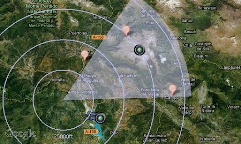
* Geo-Pictures are photos with additional geodata such as GPS location, compass orientation pitch and roll altitude. These data are added to the EXIF metadata. They can be used as overlays on photos. With the export function, you can view all your pictures in Google Maps and on Google Earth. These albums can be shared with everyone who is able to run Google Earth.
* Geo-Videos Pro: The first app that allows you to record videos using an embedded layer of geodata. This app is a useful complement to photos. With Geocam Studio (available on geocam.wazar-apps.com) customize and export these videos and share them.
* Geo-Reports: Export and Share PDF Reports with Your Pictures Bearing Their Location on a Map and your Comments
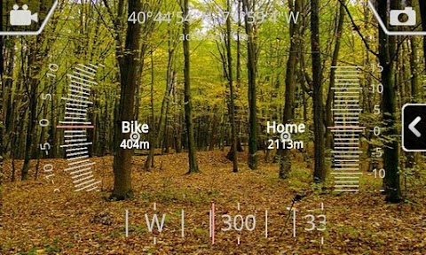
Geocam: This accurate measurement tool is for bearings. You can choose between geographic North or magnetic North. It also shows you your inclination, elevation and cursors that are readable (such as a cockpit HUD). You can use it to map terrain on your glideboat mountain biking.
* Geo-Caching: Create a map of the area, and then view it with your camera using augmented reality. Name distance. It doesn't require an offline data connection so you can use it when hiking in another country. It will allow you to ensure you're following the correct path and show you how far you have left. With the Add Here option, you can add markers to your hike. For example, flagging the base camp or a water source is one way. Or any other interesting information that you discover along the trail.
* Measurements: Use the triangulation function to measure the distance from any object. Once the distance has been established, you can measure the object's height. It is done with mathematical formulas and not a cursor that cannot be read. You can choose between imperial and metric measures systems.
Geocam supports extensive customisation including:
* Choose which indicator(s) to show on your HUD. Also, whether you want to save or delete them on photos
* Imperial and Metric systems
* GPS Formats: Decimal degrees degrees/minutes/second MGRS UTM
* Magnetic north or true north
* Compass readings in degrees or mils
* Percentage of or degrees slopes
* Calculating zero pitch and rolling to custom values in order to measure the differences
* Different styles, including hi-vis or cockpit designs.
Important Note: We cannot assist you with an issue if only a review is left. We can help you by getting in touch via email. All emails are answered promptly and we regularly send out solutions to problems reported. If you have any questions, please don't hesitate to contact us.