Altimeter & Altitude Widget Mod Apk
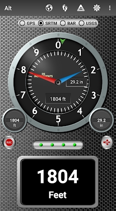
DS Altimeter can be used as an altitude logger or mapper. The app can show and optionally track your altitude, as well as allow you to search for altitudes in other places. The best data sources for elevation information include:
1. NASA’s Shuttle Radar Topography Mission provides location-based altitude.
2. Satellite-based altitude (GPS Altitude) is corrected for height above the mean sea level (AMSL).
3. The United States Geologic Survey provides accurate land survey elevation values for any location. This is available to customers within the United States, Canada, and Mexico.
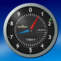
4. Barometer sensors can be used to measure pressure. This is then converted into elevation above the sea level. To get the best readings, calibrate your pressure altitude.
Four calibration tools are available with the barometric altimeter:
1. Calculate to the closest airport. The app’s dynamic listing of nearby airports allows you to choose your preferred airport. The app updates airfield information every 20-30 minutes.
2. You can enter a QNH value.
3. For your specific location, enter the altitude benchmark.
4. Compare the barometric altimeter with the SRTM elevation map.
DS Altimeter works offline. It does not need an internet connection to calculate barometric altitude or GPS altitude.
NEW IN DS ALTIMETER:
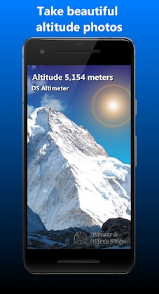
* Photo altimeter. Take a photo of the highest places you love with the indicated altitude.
Tap 2 points on the map to quickly find out about altitude differences and grades between locations.
• Record elevation profiles and tracks to help you plan your favourite journeys in the highlands, lowlands, and everywhere else!
* [SPECIAL] See your altitude recording on the maps that include all tracks points. To see the altitude of any track point, tap it.
* Elevation search: Type a name or an address to find the elevation above sea level for that area.
You can upgrade the app to Pro to unlock even more features, including the Altimeter widget.
Going skiing? Take a photo of your skiing run and record it with DS Altimeter. The included maps will show your trail along with the elevation points. Your run’s minimum and maximum elevation points will be displayed.
DS Altimeter also includes altitude mapping (lake or sea depths) and bathymetry. To find the altitude and water depth for that area, tap anywhere on a map.
* This application also includes detailed assistance.
This altimeter is perfect for hiking and skiing, mountain climbing or any other outdoor sport.
Privacy and Permissions:
DS Software doesn’t collect personal data such as user accounts or phone numbers.
1. If required, location permission is needed for GPS. GPS data can be used to match altitudes on land and determine elevations above Geoid (then adjusted to sea level).
2. You will need permission to screen-capture your results in order to be able share an image.
3. You will need to wake-up (Wake Up) and boot permission to refresh the Altimeter Widget’s values and to activate the Altimeter Widget if the phone is restarted or rebooted.
4. Access to online databases of land surveys in government facilities requires Internet and Network permissions.
5. To activate the altimeter widget, remove advertisements and receive unlimited altitude track recordings, you will need to obtain billing permission.
6. To vibrate your phone to receive important notifications, you can give permission by clicking the “Vibrate Permission” button.


Leave a Reply